The ubiquitous spaghetti plots from online model promotors made their first big appearance of the year late yesterday afternoon for a fledgling disturbance in the far eastern Atlantic, but reality-based meteorology says buyer beware.
We continue to follow two disturbances today – both tropical waves – moving through the Atlantic and separated by over 2,000 miles of tropical seas.
The leading wave is sailing along through the central Caribbean south of the Dominican Republic with little shower activity. Between increasingly hostile wind shear and pockets of nearby mid-level dryness, development odds remain low. Regardless of development, the system will be moving inland into parts of Central America or southeastern Mexico by early next week.
For the week ahead, our main area of interest will be the still-organizing disturbance broadly centered about 1200 miles west of the African coast.
Satellite wind estimates from earlier this morning found light surface winds turning along the northeastern side of the larger region of storminess. This area of greatest spin is denoted by the yellow X on the National Hurricane Center’s morning tropical weather outlook.
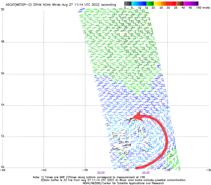

The sprawling region of low pressure is discombobulated to be generous, so don’t expect quick development.
By early to middle next week, the environment is forecast to become more hospitable and should allow for the system to congeal. Exactly where and when that happens is still an open question, but our most reliable forecast models suggest an organizing system in the vicinity of the northernmost Caribbean islands by late next week.
Interests in Puerto Rico and the U.S. Virgin Islands should keep an eye to the changing forecasts over the coming week.
For us on the mainland U.S. it’s far too early to speculate.
You’ll likely see lots of online conjecture strung along high-level weather-speak attached to complex charts offering bold analyses into Labor Day, but forecasts that far into the future, especially for a storm that hasn’t formed, are pure guesswork.
The typical track error from the world’s best hurricane forecasters is over 150 miles five days out – remarkably good compared to just a decade ago but still the difference between Miami and Melbourne. And that’s five days out for well-formed systems.
Going beyond five days for systems that haven’t formed and going beyond five days, skill is degraded further and extended forecasts can vary wildly.
Subtle but important uncertainties of today like where a center forms, circulation structure, short-term movement, and intensity can have dramatic effects on extended-range forecasts. These storm-specific uncertainties are complicated by changes in upstream weather systems that further muddy the big picture.
The bottom line for South Florida is don’t get caught up in the hype, but continue to check back. If the eastern Atlantic disturbance is a baseball game, we’re at the top of the first of a nine-inning ballgame.
Copyright 2022 by WPLG Local10.com - All rights reserved.
